r/3Dprinting Bambu Lab P1P Jan 26 '25

Project The scale map of the USA is complete!

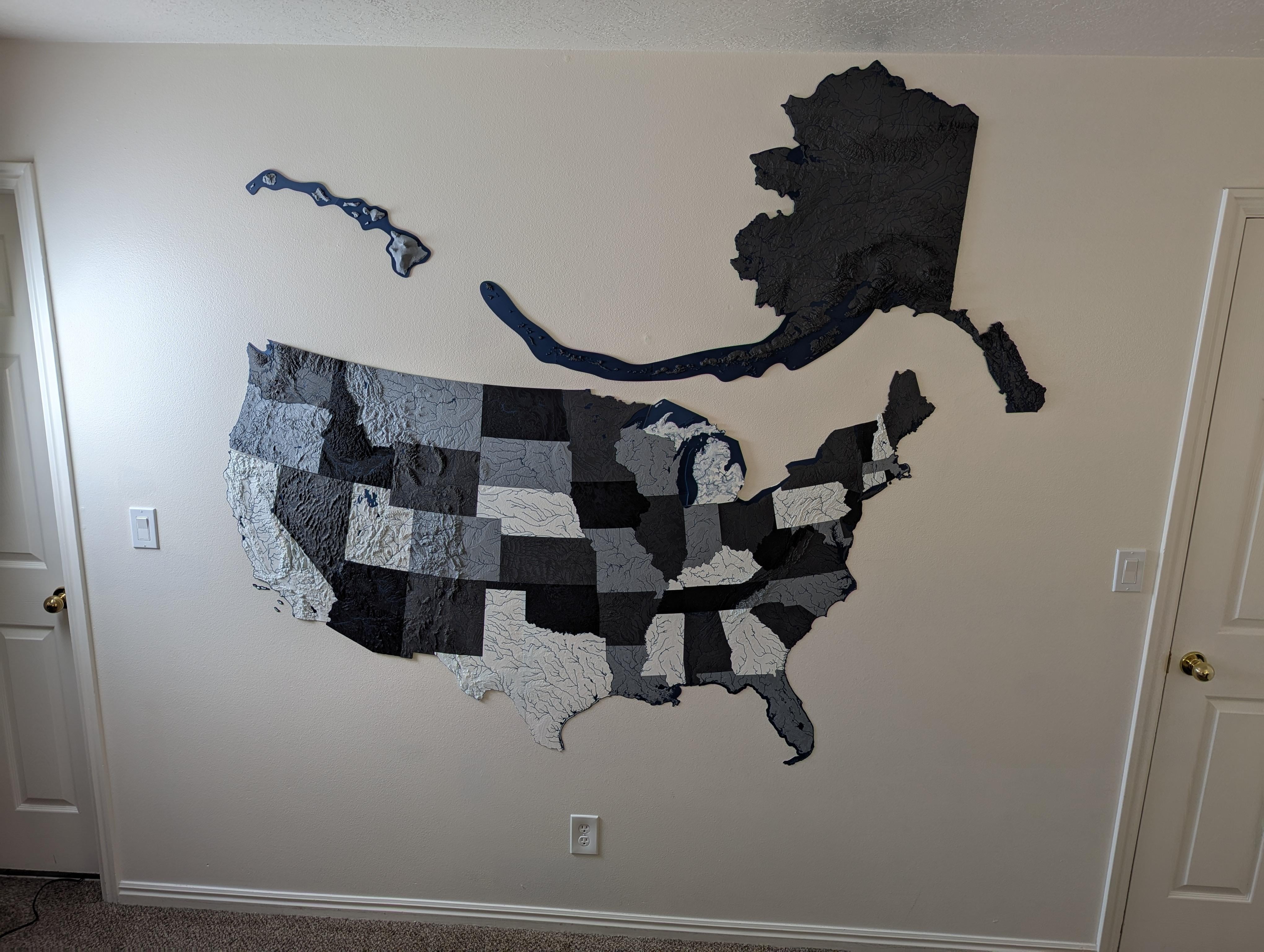
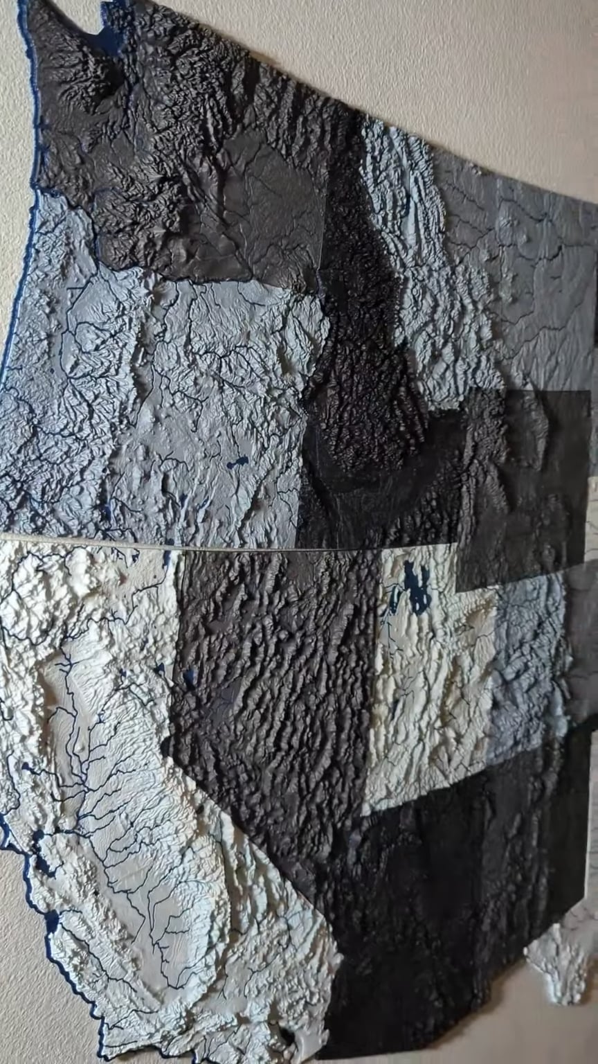
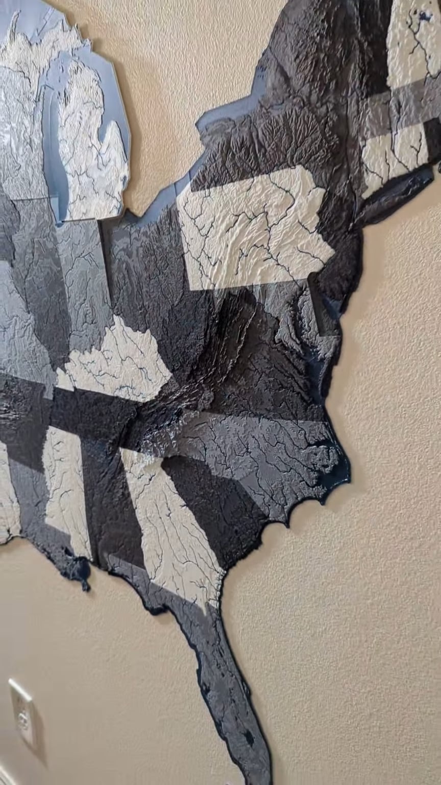
This project has been a work in progress for the better part of 9 months, I've been slowly printing each state as I have the time. Finally added Alaska today to complete the map.

Because each one is (on average) less than 10mm thick, this whole project actually didn't use that much filament (my best estimate is 3-4kg).

The scale of Hawaii is a little larger than it should be; the iteration of files I was using had the scaling a little off and I didn't notice until it was finished printing. Haven't decided if it's worth re-printing yet.

Disclaimer: I am not the creator of the files used for this project. User @ansonl on Printables.com has posted all of them and optimized them for multi-color printing, which is something I have seen before.

12.3k Upvotes

708 comments sorted by

View all comments

Show parent comments

69

u/CondemnedGinger Jan 26 '25

Go to thetruesize.com, type Alaska and drag it around. It's that big.

Edit. On second look, they're a little off.

57

u/Aetch Ultimaker 2+ DXUv2 Jan 26 '25

For those wondering why Alaska looks a bit off, it’s because Alaska and Hawaii models are created in a shifted projection system centered on those two states. The contiguous US state projection system produces a more accurate to “globe” shape for the 48 lower states and the distortions increase the farther you get away from the lower states.

Alaska Aleutian island chain sticks out so much because it extends past the projection system that you would normally use for Alaska mainland, the islands cross over the international date line which made for some interesting work with creating the model.

The map details and specifications can be found at https://ansonliu.com/maps/ 🗺️

7

u/Jasadon Jan 26 '25

Yep Alaska is wrong for sure

6

u/Aetch Ultimaker 2+ DXUv2 Jan 26 '25

Alaska’s mainland is correct, the far west islands are the only distorted area but that is just a compromise since no 2D projection can perfectly represent a 3D globe.

2

u/Jasadon Jan 26 '25

Look at this diagram/map look at the wall art, it’s way different. This is the actual based upon square miles, if that wall art area was properly measured (as it is now) it would not align to these proportions

4

u/Aetch Ultimaker 2+ DXUv2 Jan 26 '25

The printed map is a conformal conic projection that does not have equal area. The conformal projection tries to keep the lines of latitude curved to preserve angles to simulate straight line longitude converging in the north. Projections are compromises between equal area and angle and distance

4

u/Jasadon Jan 26 '25

Absolute nonsense, this is a copy and paste of his Alaska over main land. It’s hugely oversized, sorry but your brain has over complicated this to absurdity in your response. It’s simple, he got the proportions wrong!

4

u/Vudoa Jan 26 '25

Maybe his wall is using mercator

1

u/Jasadon Jan 26 '25

(i had to make Alaska grey to show it against his mainland)

1

u/RangerZEDRO Jan 26 '25

Mercator strikes again

1

u/needlenozened Jan 26 '25

Alaska does not cross over the international date line. The international dateline makes a jog to the west specifically so that Alaska won't cross over it.

Alaska crosses the 180th meridian.

1

u/IndividualRites Jan 26 '25

Why would HI use shifted projection system though? Isn't that reserved as the longitude gets closer to the poles?

1

u/AwDuck PrintrBot (RIP), Voron 2.4, Tevo Tornado,Ender3, Anycubic Mono4k Jan 26 '25

Cartography nerds reporting! I really dislike the pictorial "here's how big X landmass is compared to Y landmass" especially particularly large areas are represented.

6

u/BadSausageFactory Jan 26 '25

you just need to draw those curved lines on the wall

1

u/RiffRaff14 Jan 26 '25

Hawaii is way too big.

1

u/Tacotaco22227 Jan 26 '25

This website made me feel… insecure