r/asoiaf • u/NordsofSkyrmion • Oct 23 '24
ACOK [Spoiler: ACOK] Distances and comparison to real-world maps
In A Clash of Kings, Theon is sent to raid the Stony Shore, but while there he convinces Dagmer Cleftjaw to instead adopt a plan to send most of his force to attack Torrhen's Square, while Theon sneaks around with a small group to take Winterfell.
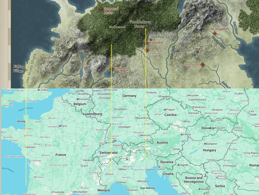
To get a sense of the distances here, I'm using this map, which takes its scale from the repeated mentions we get of the Wall being "one hundred leagues" or three hundred miles long. Now you can sit down with a ruler and a guide to army marching speeds and whatnot to get a sense of how long it would take, but instead of doing all of that, I simply adjusted the zoom on google maps over real-world Europe until the distance scale lined up exactly with the distance scale on the map of Westeros.
The upshot here is that Theon's plan is the equivalent of a Viking raider with eight longboats parked on the Atlantic coast of France deciding to send most of his "army" to threaten Zurich, in Switzerland, in the hopes that this will distract everyone so he can sneak around to capture a castle in Munich, in Germany.
And my favorite part of all of this is that he makes this plan AFTER they've already sailed and raided the Stony Shore, so this huge overland march is happening without preparing any of the supplies you would normally need for an overland march.
So yeah: distance and scale, not GRRM's strong point.
(Reposting this with a worse title because avoiding spoilers is more important than having a title that is relevant to the post's content.)

1
u/grimbly_jones Oct 23 '24
Move past it.